双成像仪可更清晰的看清地下情况-石油圈
| 所在地区: | 广西-北海- | 发布日期: | 2020年12月2日 |
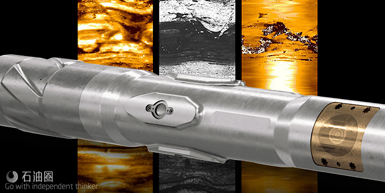
TerraSphere技术拥有电磁与超声波两只“眼睛”,可提供业界首屈一指的高分辨率井下图像。
编译丨TOM
在阿伯丁举行的SPE欧洲海洋博览会上,斯伦贝谢推出了名为TerraSphere的新技术。该技术采用随钻双物理成像仪,适用于油基泥浆的钻井作业。
TerraSphere高分辨率成像技术可在油基泥浆中提供业界首屈一指的高分辨率电阻率图像。它还能在油基泥浆体系中,随钻提供高分辨率的声波图像与井径数据。TerraSphere技术利用电磁与超声波测量,在钻进期间可实时提供井筒的高分辨率图像。
电磁子系统依靠两个夹角为180度的电极。高分辨率电磁脉冲会以多种频率,从传感器通过泥浆传输至地层。得益于发射频率的多样性,哪怕在地下环境中遭遇各种电阻率,也能获得高质量的电阻率图像。这已在碎屑岩、碳酸盐岩、页岩与蒸发岩中得到验证。
声学子系统依靠四个夹角为90度的超声波传感器。这些仪器会发出短的超声波脉冲,并探测来自井壁的回声。无论是在高密度、高衰减钻井液中,还是在轻质泥浆、井眼条件较好的井筒中,都能提供可靠的测量数据。每个传感器都聚焦于最佳分辨率,降低工具偏心度、井眼粗糙度、井眼尺寸对测量结果的影响。该系统采用两种测量方法:一种是声波时差,利用计算得到的钻井液声速,将声波时差转换为井眼半径;另一种是回波振幅,它与井壁的声阻抗有关。钻具组合的每一次旋转都会产生众多脉冲,以提供方位图像。该传感器凭借高采样率与聚焦度,提供的分辨率能够与油基泥浆、水基泥浆中的电缆超声波成像工具相媲美。
电阻率井眼图像具有最大的动态范围,突出了井壁后较短距离内的地下特征,因此通常是地质应用的首选物理参数。超声波测量对井眼表面的变化非常敏感,如裂缝、孔洞、粗糙度、台肩等。若井壁光滑且有声波对比的情况下,还可以成像出详细的岩石结构。TerraSphere技术将所有这些图像信息整合到单个工具,形成一套完整的解决方案,可在油基泥浆环境中,随钻获取详细的地质与井眼信息。这些图像是互补的,电阻率图像具有丰富的层理特征,超声图像则对裂缝与井眼状况更为敏感。
应用范围
1、用于油基泥浆中,完整描述油藏的地球科学解决方案; 2、构造、沉积学、层序地层学分析; 3、在钻进期间,利用电阻率或/和超声波图像进行无源实时地质导向; 4、地质力学与井壁稳定性的实时评估; 5、岩性与岩相识别; 6、裂缝识别与表征; 7、利用井径仪进行360度详细的井眼形状与变形分析。
现场应用
TerraSphere技术在墨西哥湾、中东、北非、北海与美国大陆进行了30多次现场试验。斯伦贝谢表示,这些试验包括构造与地层的分析成像,发现裂缝,从而避免井漏事故。该公司补充道,这项新技术可获得更多、分辨率更高的数据,减少了后续作业时间,提高了产层的净/毛比。
在北海,某客户在Balder油田的一个复杂油藏中使用了TerraSphere服务。双成像技术可随钻描绘出储层中的砂岩,消除了常规测井技术的模糊性,并通过增加储层覆盖面积来提供更准确的特征描述,从而最大限度地提高了生产潜力。如今,超声波成像捕捉到的分辨率已经能够精确到毫米,在以往只有电缆成像仪才能达到如此高的精度。
斯伦贝谢钻井与测量公司总裁Tarek Rizk表示:“当使用油基泥浆钻井时,钻井人员无法实时观察到地下特征。TerraSphere技术提供的地质与地质力学数据,不仅节省了测井时间以及相关的钻机成本,还降低了钻井泥浆进入地层裂缝的潜在风险。”
Schlumberger Unveils TerraSphere high-definition dual-imaging-while-drilling service
The new service, TerraSphere, introduced at the SPE Offshore Europe Conference and Exhibition in Aberdeen, applies a logging-while-drilling dual-physics imager for oil-based mud for drilling oil and gas wells.
TerraSphere* high-definition dual-imaging-while-drilling service delivers industry-first high-resolution resistivity images in OBM. It also provides high-resolution acoustic images and caliper data while drilling in OBM systems. TerraSphere service uses electromagnetic and ultrasonic measurements to provide high-resolution images of the borehole in real time while drilling.
The electromagnetic subsystem uses two electrodes 180 degrees apart. High resolution electromagnetic pulses are sent through the mud from the sensor to the formation at multiple frequencies. The wide range of firing frequencies produces the best quality resistivity image across the broad range of resistivities encountered in subsurface geological environments. This has been proved in clastics, carbonates, shales, and evaporites.
The acoustic subsystem uses four ultrasonic transducers 90 degrees apart. These emit short ultrasonic pulses and detect the resulting echoes from the borehole wall. These provide robust measurements in high-mud-weight drilling fluids with high attenuation, as well as in boreholes with lighter muds and good hole conditions. Each transducer is focused for optimum resolution and to reduce sensitivity to tool eccentricity and borehole roughness or diameter changes. Two measurements are made: The first is travel time, which is converted to borehole radius using calculated acoustic velocity of the drilling fluid; and the second is echo amplitude, which responds to acoustic impedance of the borehole wall. Numerous bursts are made in each rotation of the drilling assembly to provide an azimuthal image. The high sampling rates and focusing of the sensors deliver a resolution comparable to wireline ultrasonic imaging tools in OBM and water-based mud (WBM) systems.
Resistivity borehole images are usually the preferred physics for geological applications as they have the largest dynamic range and highlight subsurface features a small distance past the borehole wall. The ultrasonic measurements are very sensitive to variations in the surface of the borehole such as fractures, vugs, rugosity, and ledges. Detailed rock fabric can also be imaged where the acoustic contrast is present and the borehole surface is smooth. TerraSphere service co-locates these image physics in a single tool, providing a complete solution for detailed geological and borehole understanding in OBM environments while drilling. The images are complementary, with the resistivity images rich in bedding features and the ultrasonic images more sensitive to fractures and borehole conditions.
APPLICATIONS
Geoscience solutions for complete reservoir description in oil-based mud (OBM); Structural analysis, sedimentology, and sequence stratigraphy; Sourceless geosteering with resistivity or ultrasonic images, or both, in real time while drilling; Real-time geomechanics and wellbore stability; Lithology and facies identification; Fracture identification and characterization; 360 degree detailed borehole shape and deformation analysis with calipers.
More than 30 field trials were conducted with the TerraSphere service in the Gulf of Mexico, Middle East, North Africa, North Sea and US land. These trials included imaging for structural and stratigraphic analysis, revealing breakout fractures that enabled drillers to avoid mud loss, Schlumberger said, adding, the new service acquired additional and higher definition data, reducing subsequent operational time and improving net-to-gross ratio in the payzone.
In the North Sea, a customer used the TerraSphere service in a complex reservoir in Balder Field. Dual imaging while drilling delineated sand injectites in the reservoir and removed ambiguity from conventional logs, providing more accurate characterization through increased reservoir coverage to maximize production potential. The resolution captured by ultrasonic images is now refined to millimeters―previously possible only with wireline imagers.
“Drillers have been unable to visualize, in real time, subsurface features when drilling with oil-based mud,” said Tarek Rizk, president, Drilling & Measurements, Schlumberger. “The TerraSphere service delivers geological and geomechanical data that not only saves logging time and related rig costs, but also reduces the potential risk for lost circulation of drilling muds into formation fractures.”
按照客观、公正、公开的原则,本条信息受业主方委托独家指定在中国建设招标网 www.jszhaobiao.com 发布
注册会员 享受贴心服务
标讯查询服务
让您全面及时掌握全国各省市拟建、报批、立项、施工在建项目的项目信息。
帮您跟对合适的项目、找对准确的负责人、全面掌握各项目的业主单位、设计院、总包单位、施工企业的项目 经理、项目负责人的详细联系方式。
帮您第一时间获得全国项目业主、招标代理公司和政府采购中心发布的招标、中标项目信息。
标讯定制服务
根据您的关注重点定制项目,从海量项目中筛选出符合您要求和标准的工程并及时找出关键负责人和联系方式。
根据您的需要,向您指定的手机、电子邮箱及时反馈项目进展情况。